Gien – Sully-sur-Loire

Gien – Sully-sur-Loire

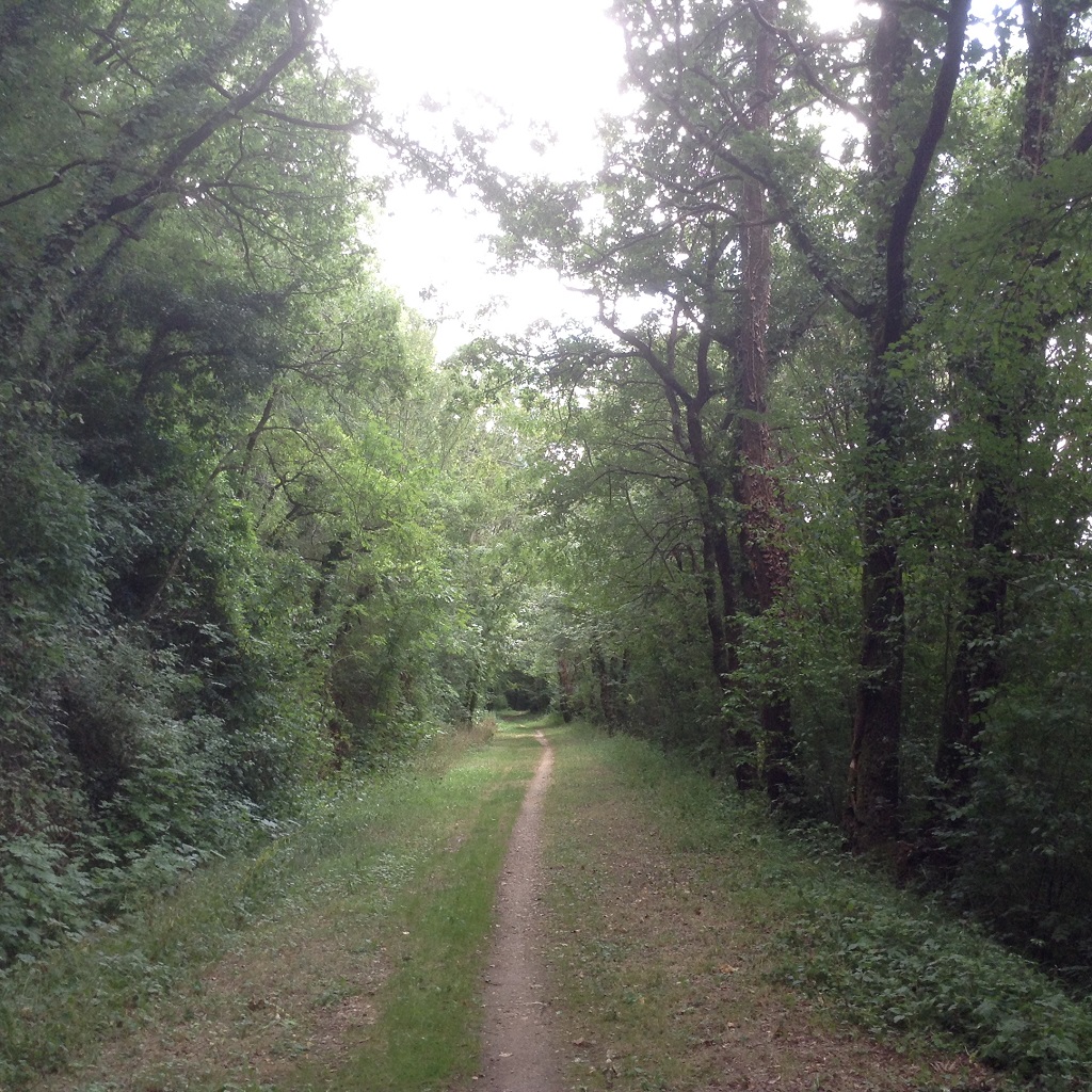
The route first runs alongside the Loire, then turns inland towards Saint-Florent, where the view is superb. It then descends towards Lion-en-Sullias, where you should not miss the kilometre marker on the D951 indicating that you are equidistant from the source of the Loire (Mont Gerbier des Joncs) and Saint-Nazaire. It then leads to the greenway, where you can observe the many birds on the gravel banks in the middle of the river. Osprey? Garden warbler? Little egret? In Sully-sur-Loire, you will pass by the foot of its magnificent castle, which is reflected in the water of its wide moat.

28.1 km
2h30

good

easy

FR : Giennois

< Gien

Sully >

climb infos
descent infos
highest infos
lowest infos

Elevation cursor map

Itinerary Eurovelo3, recommended by CTE

  • Sully-sur-Loire
  • Gien station:
  • Intercités Paris-Bercy <=> Montargis – Gien – Briare – Nevers
  • TER Paris-Bercy <=> Nevers, stopping at Gien
Lions-en-Sullias:

  • Neolithic megalith known as Le Crapaud and burial mound on the edge of the D951 road
  • Château de La Ronce, where Voltaire stayed, on the banks of the Loire
  • Cuissy Castle, which served as a refuge for Joan of Arc.

Sully-sur-Loire:

  • 15th-century castle, subsequently transformed over the centuries
  • sailors’ quarter, flood marks on some façades, traditional houses, Loire river markers.

De Nevers à l'atlantique par l'EuroVelo 6

This website is designed, created and maintained solely by volunteers, without any public or private support.
It is completely free.
Join us : https://eurovelo3.fr/adhesions/

Availles-Limouzine – Saint-Germain-de-Confolens

Availles-Limouzine – Saint-Germain-de-Confolens

This route follows a very shaded path along the old railway line. It is very grassy and passable in dry weather.

7 km

none
easy

<

>

climb infos
descent infos
highest infos
lowest infos

Elevation cursor map

Alternative route recommended by CTE

De Namur à Tours par l'Eurovélo3

This website is designed, created and maintained solely by volunteers, without any public or private support.
It is completely free.
Join us : https://eurovelo3.fr/adhesions/

Lussac-les-Châteaux – L’Isle-Jourdain par la voie verte

Lussac-les-Châteaux – L’Isle-Jourdain par la voie verte

This route, which follows the old railway line, is easy to walk in dry weather and offers plenty of shade: highly recommended on hot days.

20.2 km
2h3

none
easy

< Lussac-les-Châteaux

Lisle-Jourdain >

climb infos
descent infos
highest infos
lowest infos

Elevation cursor map

Alternative route recommended by CTE

Please note that entering Lussac-les-Châteaux is very dangerous. There is only one access route: the N147, which crosses the River Vienne. There are many heavy goods vehicles and no cycle infrastructure.

De Namur à Tours par l'Eurovélo3

This website is designed, created and maintained solely by volunteers, without any public or private support.
It is completely free.
Join us : https://eurovelo3.fr/adhesions/

L’Isle-Jourdain – Availles-Limouzine

L’Isle-Jourdain – Availles-Limouzine

In L’Isle-Jourdain, the view of the Vienne valley from the viaduct is superb.

The route to Millac winds its way through fields, woods and meadows before passing close to the hydroelectric dams that regulate the flow of the River Vienne.

16.5 km
1h30

good

medium

Montmorillonnais

< L’Isle-Jourdain

Availles-Limouzine >

climb infos
descent infos
highest infos
lowest infos

Elevation cursor map

Itinerary Eurovelo3, recommended by CTE

De Tours à la Côte Basque par l'Eurovélo3

This website is designed, created and maintained solely by volunteers, without any public or private support.
It is completely free.
Join us : https://eurovelo3.fr/adhesions/

Lussac-les-Châteaux – L’Isle-Jourdain

Lussac-les-Châteaux – L’Isle-Jourdain

Lussac-les-Châteaux is renowned for its Museum of Prehistory. It offers workshops for young visitors, family activities and guided tours of the caves.

From Lussac-les-Châteaux, the route follows narrow roads, never far from the banks of the Vienne. On the left bank, there is a beach and swimming at Queaux. On the right bank, there is a canoe and kayak centre at Moussac. At L‘Isle-Jourdain, Lake Chardes offers a playground and picnic area.


23.5 km
2h50

good

medium

Montmorillonnais

< Lussac-les-Châteaux

L’Isle-Jourdain >

climb infos
descent infos
highest infos
lowest infos

Elevation cursor map

Itinerary recommended by CTE. Partially follows Eurovelo3

  • Please note that the approach to Lussac-les-Châteaux is dangerous. There is only one access route: the N147, which crosses the River Vienne. There is heavy lorry traffic and no cycle facilities.
  • A cycle path along the route of a former railway line leads to ‘Isle Jourdain. To view it, click on the “variant lanes” icon.
To reach Queaux on the left bank of the Vienne, you can take the chain ferry “Le passeur du Gué” from Persac.

De Tours à la Côte Basque par l'Eurovélo3

This website is designed, created and maintained solely by volunteers, without any public or private support.
It is completely free.
Join us : https://eurovelo3.fr/adhesions/

Variant of the stage « Lussac-les-Châteaux – L’Isle-Jourdain »

FR : Cette variante qui emprunte l’ancienne voie ferrée est roulante par temps sec et bien ombragée : à conseiller par temps chaud.

20.2 km
0h40

none
easy

Dangé-Saint-Romain – Châtellerault

Dangé-Saint-Romain – Châtellerault

From Dangé-Saint-Romain, the route runs back from the left bank of the Vienne and leads to Châtellerault via a lovely cycle path.

15.3 km
1h3

good

easy

Chateleraudais

< Dangé-Saint-Romain

Châtellerault >

climb infos
descent infos
highest infos
lowest infos

Elevation cursor map

Itinerary Eurovelo3, recommended by CTE

De Namur à Tours par l'Eurovélo3

This website is designed, created and maintained solely by volunteers, without any public or private support.
It is completely free.
Join us : https://eurovelo3.fr/adhesions/

Alternative to the stage « Dangé-Saint-Romain – Châtellerault »

In Saint-Rémy-sur-Creuse, the road is picturesque, lined with chalk cliffs dotted with cave dwellings – shelters that were popular in medieval times and later among hemp weavers from the 17th to the 19th centuries.

The wooded route follows quiet roads towards Oyré and then enters Châtellerault via a lovely greenway.


28.8 km
2h30

none
easy
Chateleraudais

From Loire Valley to Vienne Valley

From Loire Valley to Vienne Valley

From Sainte-Maure-de-Touraine, there are two routes to Châtellerault

  • The official Scandibérique route : this leads to Châtellerault via the Vienne Valley. The roads (D1 and D18) are busy and there are few cycle facilities.
  • CycloTransEurope route : a more pleasant route to discover Descartes and the troglodyte refuges on small roads.

85 km

Touraine
Sainte Maure
Chateleraudais
Poitevin

< Tours

Châtellerault >

climb infos
descent infos
highest infos
lowest infos

Elevation cursor map

Itinerary Eurovelo3, recommended by CTE
→ click on map to go to a stage

De Tours à la Côte Basque par l'Eurovélo3

This website is designed, created and maintained solely by volunteers, without any public or private support.
It is completely free.
Join us : https://eurovelo3.fr/adhesions/

The 4 stages of the section « From Loire Valley to Vienne Valley »

Tours boasts a rich architectural heritage : the half-timbered houses and beautiful stone mansions of the historic centre, the Charlemagne Tower and its viewing platform, Saint-Gratien Cathedral…

The Maison du Vélo, located near Tours railway station, provides information (on accommodation and routes) and has a repair workshop, a shower and a relaxation area.

From Veigné to Sorigny, the route follows small country roads.

In Tours, connection with the Loire à Vélo/EuroVelo 6 and the Coeur de France cycle route – V46  In Veigné, connection with the Indre à vélo – V49 cycle route.

23 km
2h30

good
easy
Touraine

From Sorigny, the route winds its way through fields and hamlets, passing through the village of Sainte-Catherine-de-Fierbois, which has a rich religious history.

In Sainte-Maure-de-Touraine, head towards the town centre to explore the beautiful market halls on the main square, and if you want to find out everything there is to know about PDO goat’s cheese, pop into Les Passerelles, which also houses the tourist information office.


2 km
2h

good
easy
Sainte Maure

At the Maillé Memorial Centre, the guided tour will help you understand why the massacre carried out on 25 August 1944 by an SS unit remained largely unknown for fifty years.

Starting from Marcilly-sur-Vienne, set back from the left bank of the Vienne, the route leads to Dangé-Saint-Romain, a lively town on Tuesday and Saturday mornings thanks to its market, where you can sample local specialities from Tours : fouées,  rillettes and rillons, local recipes featuring goat’s cheese, and a wide variety of apples.

27 km
2h30

good
easy
Sainte Maure

From Dangé-Saint-Romain, the route runs back from the left bank of the Vienne and leads to Châtellerault via a lovely cycle path.

15.3 km
1h3

good
easy
Chateleraudais

Sainte-Maure-de-Touraine – Dangé-Saint-Romain

Sainte-Maure-de-Touraine – Dangé-Saint-Romain

At the Maillé Memorial Centre, the guided tour will help you understand why the massacre carried out on 25 August 1944 by an SS unit remained largely unknown for fifty years.

Starting from Marcilly-sur-Vienne, set back from the left bank of the Vienne, the route leads to Dangé-Saint-Romain, a lively town on Tuesday and Saturday mornings thanks to its market, where you can sample local specialities from Tours : fouées,  rillettes and rillons, local recipes featuring goat’s cheese, and a wide variety of apples.

27 km
2h30

good

easy

Sainte Maure

< Sainte-Maure-de-Touraine

Dangé-Saint-Romain >

climb infos
descent infos
highest infos
lowest infos

Elevation cursor map

Itinerary Eurovelo3, recommended by CTE

De Namur à Tours par l'Eurovélo3

This website is designed, created and maintained solely by volunteers, without any public or private support.
It is completely free.
Join us : https://eurovelo3.fr/adhesions/

Alternative to the stage « Sainte-Maure-de-Touraine – Dangé-Saint-Romain »

FR : Le parcours proposé par CycloTransEurope s’étire le long de la vallée de la Manse marquée par l’habitat troglodytique. Légèrement vallonné et paisible, il rejoint les rives de la Creuse à Descartes, ville natale du célèbre philosophe.

Le parcours de la Scandibérique, rejoint la vallée de la Vienne à Marcilly-sur-Vienne.

20 km

none
easy
FR : Sainte Maure

Loire Valley – Orléans – Blois

Loire Valley – Orléans – Blois

The route wanders between “gardened” farmland and a wild flora of poplars, willows and osiers.

The historic sites, royal castles and religious buildings become denser. It’s time to start humming “Orléans, Beaugency, Notre Dame de Cléry…”.

The final leg takes in the majestic Château de Chambord.


65 km

Orléanais
Blésois

< Orléans

Blois >

climb infos
descent infos
highest infos
lowest infos

Elevation cursor map

Itinerary Eurovelo3, recommended by CTE
→ click on map to go to a stage

De Namur à Tours par l'Eurovélo3

This website is designed, created and maintained solely by volunteers, without any public or private support.
It is completely free.
Join us : https://eurovelo3.fr/adhesions/

The 3 stages of the section « Loire Valley – Orléans – Blois »

The ride out of Orléans is a real pleasure : a cycle path along the banks of the Loire and a crossing of the Pont de l’Europe, a magnificent structure designed by the architect Calatrava.
After St-Hilaire-St-Mesmin, it’s time for the wilder side of the Loire, its islands and its confluence with the Loiret.

21.5 km
2h00

good
easy
Orléanais
Blésois

Get in on the GPT Store Gold Rush...

The castle of Meung-sur-Loire, which stands next to the collegiate church of Saint-Liphard, can be visited from the attics right down to the dungeons where the poet François Villon was imprisoned.

Halfway along the route, the medieval town of Beaugency reveals a rich cultural heritage: the remains of its fortifications, the Abbey Church of Notre-Dame, the Ursuline Convent, the 23-arch bridge, Dunois Castle…

24 km
2h

good
easy
Orléanais
Blésois

This route along the right bank is the official Scandibérique route. Two other routes, one along the left bank and the other via Chambord, lead to Blois.

A very pleasant, peaceful walk with splendid views of the Loire.


19 km
2h00

good
easy
Blésois