Orléans – Gare des Aubrais
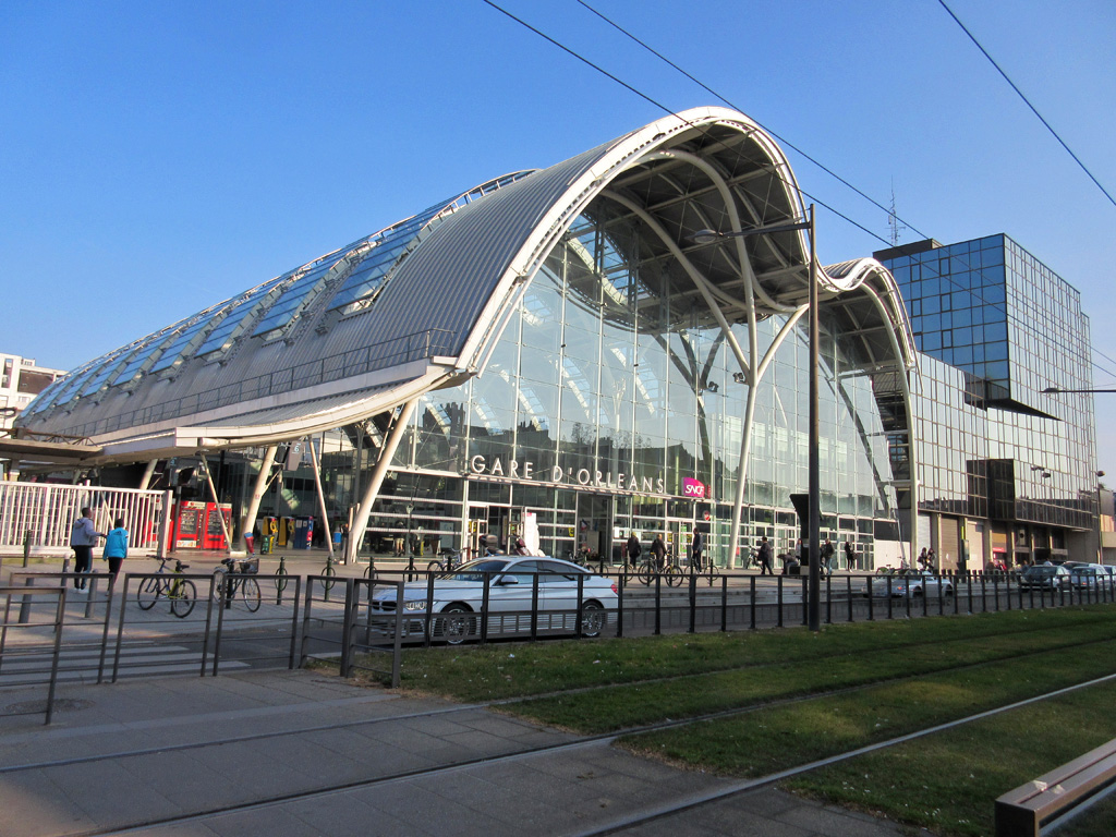
A route connecting Place d’Arc in Orléans to Fleury-les-Aubrais station.
3 km
0h20
none
easy
< Orléans
Gare des Aubrais >
Elevation cursor map
Link route recommended by CTE


A route connecting Place d’Arc in Orléans to Fleury-les-Aubrais station.
< Orléans
Gare des Aubrais >
Link route recommended by CTE

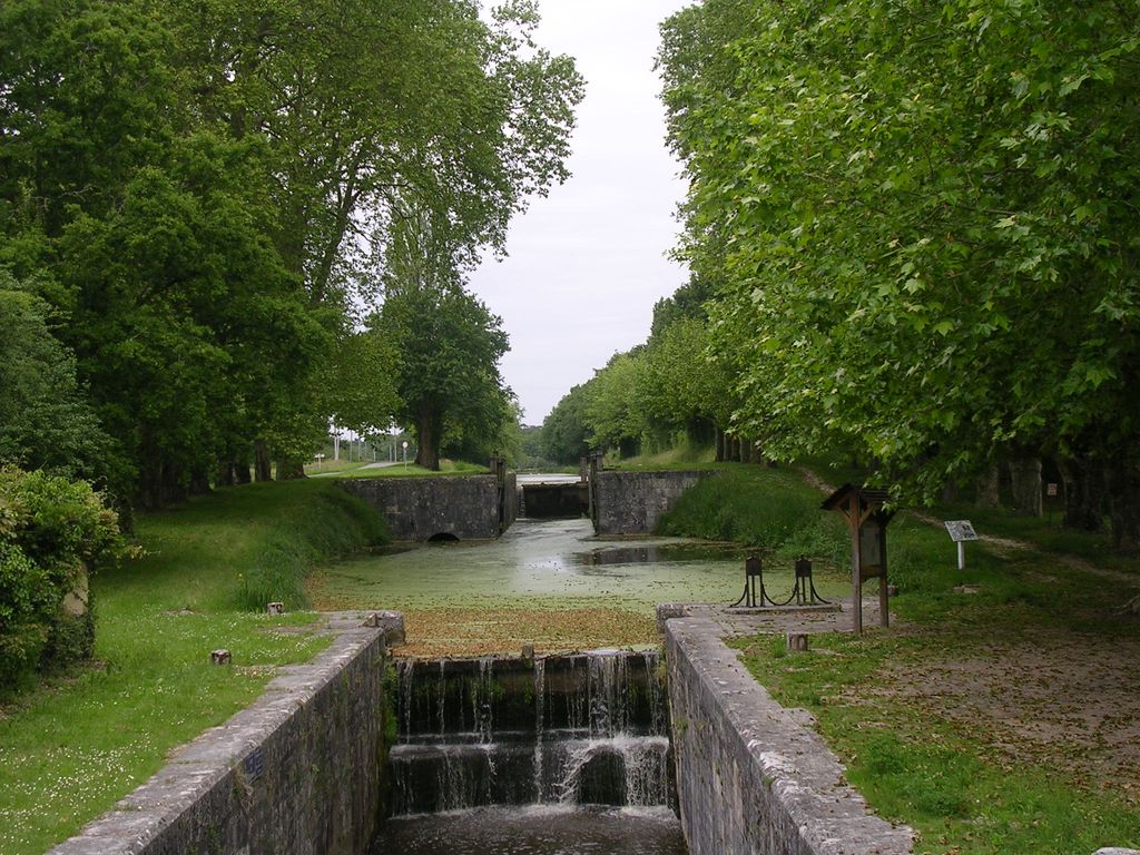
The Canal d’Orléans connects Montargis, known as the Venice of Gâtinais, to Orléans, an essential stop in the Loire Valley. The cycle route is away from the main tourist routes and winds its way along the meandering canal between forests, ponds and farms.
For more information, visit: Development of the cycle route along the Orléans Canal.
This section can also be the starting point for the loop known as “Le Loiret au fil de l’eau”, which includes the Briare Canal, the Loire Valley and the Orléans Canal.
The CyloTransEurope association remains in favour of EuroVelo 3 following the Orléans Canal.
< Montargis
Orléans >
Alternative itinerary, recommended by CTE
→ click on map to go to a stage

De Namur à Tours par l'Eurovélo3
The 4 stages of the section « Orléans Canal »

Montargis is a must-see destination (Tour Carrée, half-timbered houses, tanneries). Crossed by the Briare Canal and located at the confluence of the Loing, Puiseaux and Vernisson rivers, you will often find yourself crossing a bridge here.
The Briare Canal will take you to the Buges lock, where the Briare, Orléans and Loing canals meet. From there, you will reach the village of Chailly-en-Gatinais by following the Orléans Canal.
500 metres downstream from the May lock, don’t miss the Chevillon-sur-Huillard swing bridge.
The service area at Chailly-en-Gâtinais is very welcoming, with picnic tables, benches, a water fountain, and more.
The water divide between the Seine and the Loire begins at the Bas Grignon lock. The cycle route runs alongside the Gué des Cens and La Noue Mazone ponds.
In Combreux, enjoy the Vallée pond and its beach.

Following the canal, you will pass alongside the Forêt d’Orléans, France’s largest state-owned forest, which offers numerous cycling routes from Vitry and Fay-aux-Loges.
To the south, those wishing to join the Loire à Vélo cycle route can visit Châteauneuf-sur-Loire, an ideal base for exploring the surrounding area.

In Mardié, at a place called Pont aux Moines, you may see the Oussance, the only cruise boat on the canal, at its landing stage.
Combleux, with its beautiful banks of the Loire, the canal and its locks, make this village one of the favourite walking destinations for residents of the Orléans metropolitan area.
The 2 alternatives of the section « Orléans Canal »

53 km long, the Briare navigable canal provides a link between the Seine basin and the Loire basin.
This route, which is very pleasant in dry weather, provides an opportunity to meet lock-keepers, boatmen and tourist boats.
Numerous structures linked to inland waterway transport are dotted along the route. At Rogny-les-Sept-écluses you can see the remains of 7 successive locks.
In Briare, as well as the famous canal bridge over the Loire, don’t miss the Maison des deux Marines, which presents the history of the Loire and canal marinas.

At Briare, the cycle route joins the Loire à vélo / EuroVélo 6 route, and they run together as far as Tours.
Briare is the gateway to the Unesco World Heritage Loire landscape, with its growing number of historic sites, the river with its marshes, meadows, islands and sandy shores where colonies of birds nest, and the revival of inland waterway transport, with “gabarre” and “futreau” boats gliding along the water’s edge.
From Châtillon-Coligny to Briare via Rogny-les-Sept-Ecluses and Ouzouer-sur-Trézée. In Briare, the canal bridge allows boats to reach the lateral canal to the Loire. Don’t miss a visit to the Musée des Deux Marines, which introduces visitors to the unique features of navigation on the canal and the river.
good
easy
< Châtillon-Coligny
Briare >
Itinerary Eurovelo3, recommended by CTE
Cycling route to get to the station or the Nogent-sur-Vernisson arboretum from Montbouy.
< Montbouy
Nogent-sur-Vernisson >
Link route recommended by CTE
Route to get to Montargis station from Scandibérique.
<
>
Link route recommended by CTE
From Cepoy, you can reach Montargis station by following this alternative route which passes through Châlette. This route is shared with motor vehicles.
< Cepoy
Montargis >
Alternative route recommended by CTE
Itinerary Tab :
After crossing the footbridge, follow the Briare Canal on its right bank until you reach the Nelson Mandela Street Bridge.
At the bridge, cross to the other side and follow the canal on its left bank to the quai du patis. From there, you can reach Montargis railway station by walking up Avenue du Général de Gaulle.
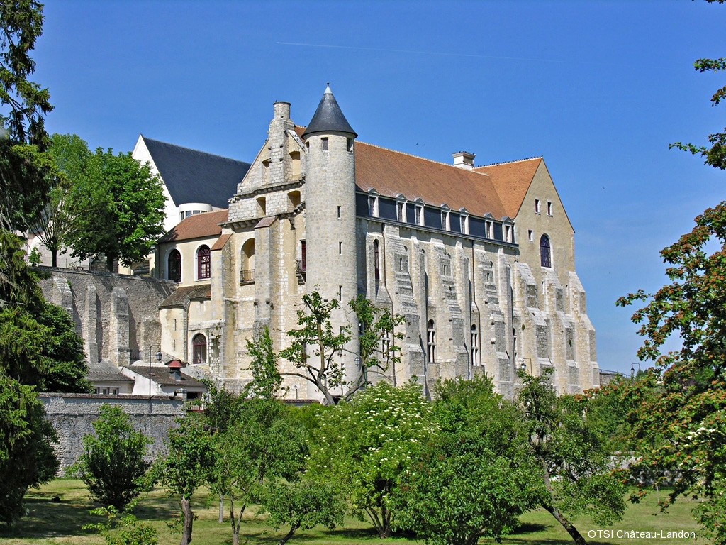
Ancient medieval fortified town. Birthplace of the Counts of Anjou and Kings of England, situated on a rocky outcrop overlooking the Fusain valley.
The town bears witness to a prestigious medieval past and is well worth a visit.
< Château-Landon
Château-Landon >
Alternative route recommended by CTE
Itinerary Tab :
When you reach Rue Saint-Séverin, turn left and then right onto Rue de la Ville Forte, which goes around Saint Séverin Abbey. The climb is steep. At the end of the street, turn right onto Rue Hetzel. You can find a map of the town at the tourist office. There are bicycle racks on the market square.
To leave, take Albert Ouvré Street, then at General Leclerc Square, take Nemours Street. Next, follow Charles de Gaulle Street until you reach Bas de Saint-André Street, which will be on your right. Go down this street until you reach Chemin de la Haie de Banse. Stay on this road until you reach the first road on the left, which will take you to a bridge over the Fusain.
After the bridge, turn left immediately. Cross Tabarderie Park (picnic area) along the Fusain until you reach the road. At the road, turn right onto Rue des Gauthiers. At the end of the hamlet of Les Gauthiers, turn left onto the D43 to the hamlet of Néronville and the Loing Canal, where you will rejoin the cycle route.
Information Tab :
Mustsee Tab :
Addresses Tab :
The Tino Rossi Garden, between the Seine and contemporary sculptures, offers a pleasant stroll. In summer, the atmosphere is festive with evening dances where you can learn tango, salsa and other dances.
This route, open day and night, bypasses the Henri IV tunnel on the right bank, which is closed from 10:30 p.m. to 7:45 a.m.
<
>
Alternative route recommended by CTE
This connection leads to the RER-B at Mitry-Claye , which has a much more frequent service than Crépy-en-Valois.
<
>
Link route recommended by CTE
This more direct route passes through Place de la Bastille, runs alongside Canal Saint-Martin once again, and joins EuroVelo 3 near the Seine.
<
>
Alternative route recommended by CTE